Froghall Drive - the Maps
Chris French, May 2020
Introduction
There follow some maps of Froghall Drive, starting with the present day (almost) and working backwards about 200 years, in 7 steps.
In all cases (bar one) I've tried to crop the maps to the same shape and with the same coverage, to make comparisons easier.
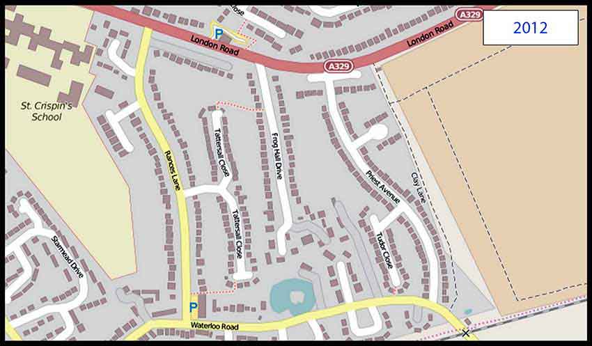
2012: Here we have what we know today - give or take the new houses being built east of Clay Lane. I'm using OpenStreetMap in this case, because it's the most up to date and it has the street names. OpenStreetMaps are created and maintained by volunteers. A disadvantage is that is doesn't show the garden/land owned by each house.
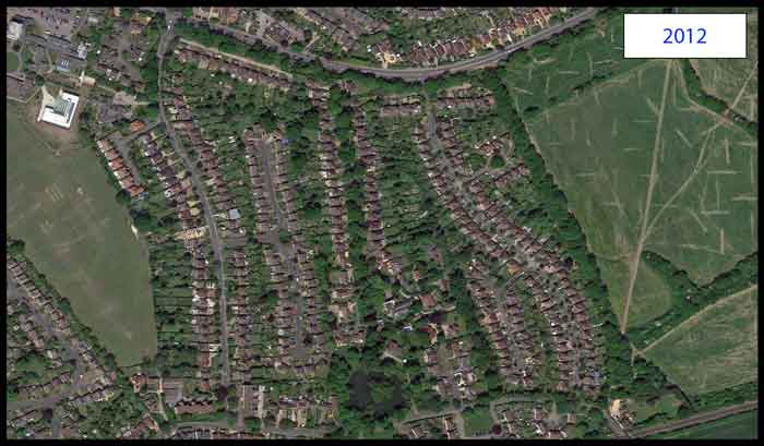
2012 again: If you prefer, here's a shot taken from my helicopter (or was it Google Maps?). As we know, in the real Google Maps you can zoom in and see what's on someone's washing line ......
Another item that is more obvious than in the maps is the strip of trees runnng north-east from the near southern end of Clay Lane.
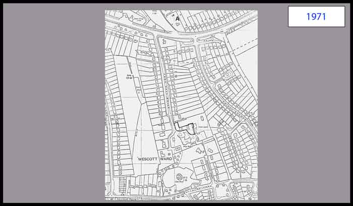
1971: This map does not cover the same area as the rest, but most importantly fills in the gap between the 2012 and 1958. The key thing is that it shows in detail all the houses built on both sides of the drive (except for the newest ones such as 47A).
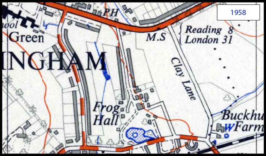
1958: Going back 50 years shows a significant set of differences:
- No Priest Avenue.
- No Tattersall Close - just the pond and streams that it is built over.
- Most of FHD has been built along, but not all.
- There are houses on the north side of London Road, but not the Bean Oak estate. Also a few opposite the pub.
- There are no shops on Rances Lane.
- Buckhurst Farm is prominent.
- The area round St Crispins was called "Frogall Green" on this map. On all earlier maps it is correctly spelt "Froghall Green", so I assume this is a typo.
- The only road named is Clay Lane.
- What is now Buckhurst Grove appears to give a secondary access to the hall, from Waterloo Road.
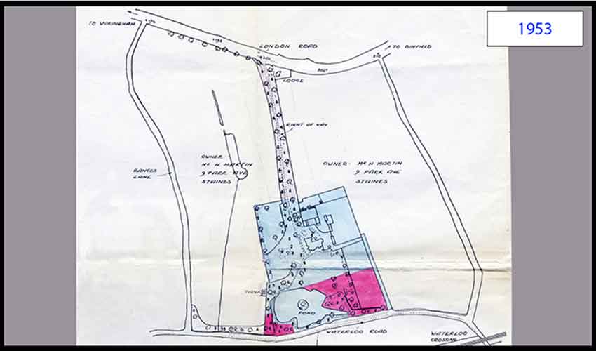
1953: Again, this map (trimmed from a larger plan) does not cover the same area as the rest, but shows that 5 years earlier the houses had not been built down the main part of the drive. It shows who owned the land either side of the drive, a Mr. Martin from Staines. The full map shows that the land south of Waterloo Road is a "Council Estate".
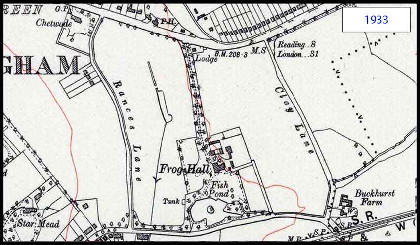
1933: Just 20 years earlier and back to an Ordnance Survey map:
- At this stage there are no houses on FHD, except the lodge and the hall's buildings.
- There are only 3 houses on Rances Lane - and Chetwode.
- Star Mead is another obvious large house.
- We have the Southern Railway - Staines & Wokingham Branch.

1900: Another 30 years back and:
- No houses on Rances Lane.
- No lodge on FHD.
- Frog Hall has not yet incororated the area to the west of the house into its gardens, but otherwise appears near enough the same.
- We have the London and South Western Railway - Staines Wokingham and Reading Branch.
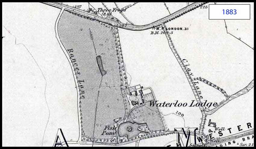
1883: The last jump back which gives a decent level of detail, I'm afraid. Now we see:
- Frog Hall has its original name - Waterloo Lodge (linked by name to Waterloo Road).
- The only 3 marked buildings are Waterloo Lodge, Buckhurst Farm (not named) and the Three Frogs.
To add to this, I'll next show FHD, in 1883, in the context of the whole of the east side of Wokingham ............
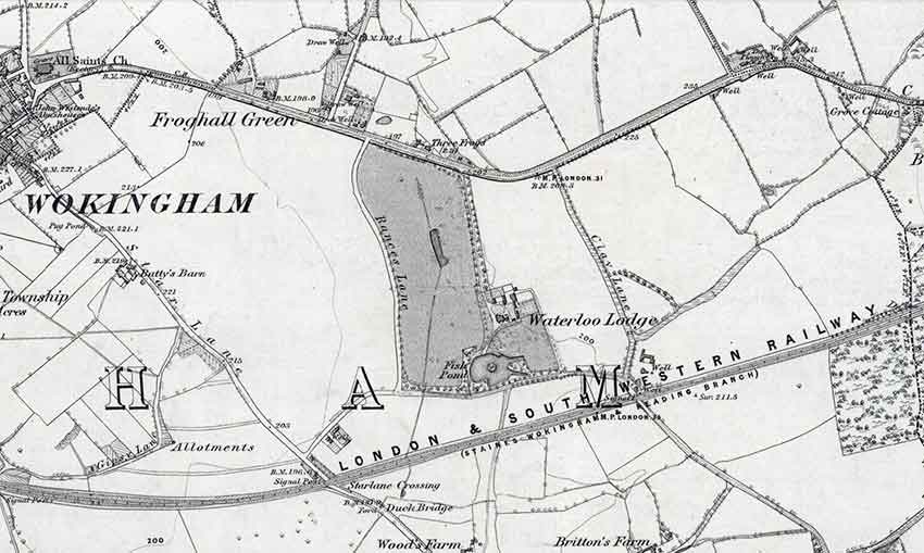
Now we can see how isolated the hall/lodge was and the Three Frogs was out in the sticks - I wonder where their custom came from?
The railway from Reigate to Reading was opened in 1849, while "our" railway, from Staines, was opened in 1856 and a joint station in Reading with the Great Western completed two years later.
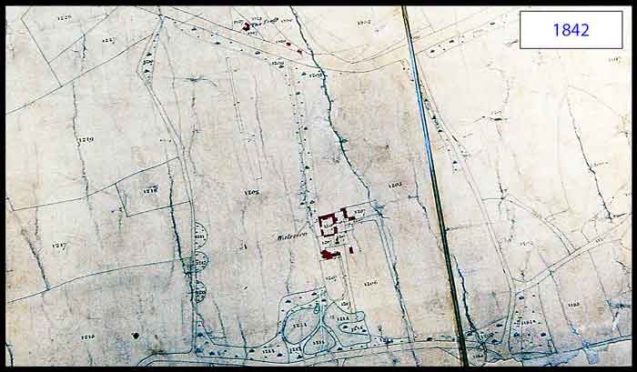
1842: This is a Berkshire Enclosures map, rather than an OS map. Enclosures were fields or plots of land and these maps concentrate on who owns which bits of land, but we don't have the names to associate with the plot numbering.
- Rances Lane and Clay Lane are there (though not named).
- There are several buildings, shown in some detail, making up Waterloo (Lodge) and its associated cottages and barns.
- The hall's lake is in three parts.
- The site of the Three Frogs is marked with the word "The Frogs". Whether it is a pub or a private house, we can't tell. There are also a couple of other buildings to the east of it - all conveniently coloured in red.
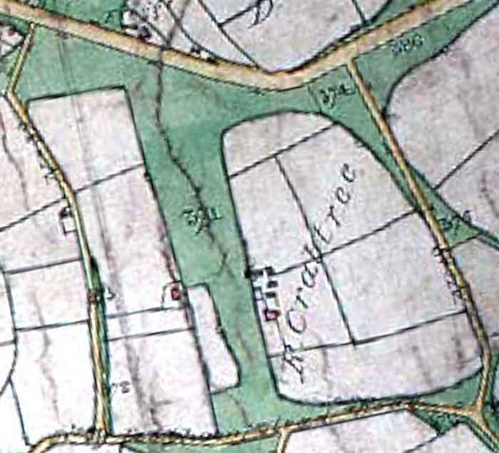
1817: This is another Berkshire Enclosures map, rather than an OS map. Although somewhat lacking in detail, compared with earlier maps, it gives us a few interesting facts:
- Rances Lane is there (whatever it was called then).
- Clay Lane was also a significant lane, although the farm isn't shown.
- There are some buildings in the vicinity of Frog Hall, in the plot of land owned by "R Crabtree".
- The drive to the hall is not as clearly marked as before and the lake does not exist.
- The site of the Three Frogs is marked with the word "Froggs".